Saturday, October 26, 2013

Hike 5: Homestead Valley trailhead to Cedar Falls trailhead

Driving there:  From Eastbound I-90 exit 38, turn south a short distance.  Turn right up the hill to the Homestead Valley trailhead.  Discover pass required.  There's a machine at the entrance to the parking lot.  I don't know if it takes cash or credit cards.

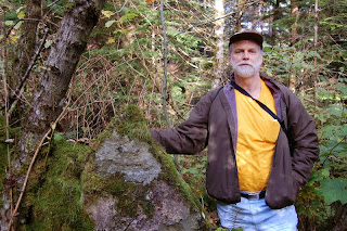
And you thought he was just a legend...
Follow the trail up to a gravel road.  Turn right and follow the road up to the John Wayne trail.  It was fairly sunny, but cool.  The leaves are starting to pile up on the trail.  We passed a lot of unmarked side trails, where do they all go?  Passed Twin Falls trail on the right.  We continued past a power substation and the Ragnar sign.  All of these big railroad signs refer to little towns that no longer exist.  Boetzke creek trestle was nice, then Weeks creek.  An unmarked trail on the right led to a view down a powerline and the south fork valley.  Passed Cedar Butte trail on the left, then Boxley creek.  Saw another unmarked side trail on the right, it looks maintained but no sign to tell us where it goes.  Passed Cedar Falls sign.  Turned right onto a short trail that led to the Cedar Falls trailhead.

We haven't seen much in the way of animals so far, just a few birds and squirrels.  I guess they saw us first.

This is the western end of the John Wayne/Iron Horse trail.  But the journey has just begun...
The amazing ant people on Rattlesnake ledge

Side trip:  Twin Falls

Side trip:  Cedar Butte

Side trip:  Rattlesnake ledge has a great view, and it's not too difficult a climb.  It's pretty crowded on a summer weekend.


Hike 4: McClellan Butte trailhead to Homestead Valley trailhead

Driving there:  At I-90 exit 42 turn south.  A short distance after the pavement ends, turn right up a narrow road to the McClellan Butte trailhead.  A Northwest Forest pass is required.  There's no place here to buy one.  Find a place to buy one here.

From the trailhead hike up the hill through the shady woods, crossing an old logging road.  The sign directs you to the right, but you can also continue up the hill to the John Wayne trail.  If you like railroads you'll love today's hike.  It's kind of amazing how they managed to build a railroad on the side of a cliff.  It was another sunny Fall day, warm in the sun and cool in the shade.  This time of year, the trail is mostly shady.  There's a lot of freeway noise here, the trail is above I-90 but still close to it.
Lisa goes rock climbing
Watch out for that first step!
We crossed Road 9020 at Garcia and continued on to Mine Creek.  From the trestle you can see long straight lines painted on the talus slope.  It reminds me of Nazca lines.
Mine creek trestle.
Nazca lines?  I zoomed in from a distance, so it's hard to see just how big it really is.
We proceeded to the Hall (not Hull) creek trestle, followed by the Change creek trestle.  At the west end we found a sunny spot to eat lunch and enjoy the view.  This is the beginning of the Deception Crags rock climbing area.


The trail continues past more cliffs and climbers.  Eventually we came to a the Homestead Valley trailhead turnoff, a gravel road that goes a short distance to a trail on the left that took us to the parking lot.  This might have been 6+ miles, we were pretty tired at the end.

Side trip:  At the east end of the Hall creek trestle, there are two trails.  The appropriately named Zigzag trail goes up the mountainside a quarter mile or so and forks.  The right fork goes another quarter mile or so to a waterfall on Hall creek.  The left fork continues up to logging roads and other trails.  Back at the trestle, the Hall creek trail goes down to old US 10 in Ollalie state park.

Side trip:  Between Hall creek and Change creek the Change creek trail climbs steeply up the mountainside to who knows where.  It has a few good views, but you have to work for them.
View from Change creek trail.  Hall creek trestle lower right.

Side trip:  At the west end of the Change creek trestle a short trail goes down to old US 10.
Friday, October 25, 2013

Hike 3: Hansen Creek road to McClellan Butte trailhead


Driving there:  At I-90 exit 47, turn south.  When the road makes a T, turn right and drive a couple of miles.  Turn left onto road 5510 and go a mile or so to the trestle.  Look sharp, the trestle is big but the trees can hide it.  Just past the trestle the road is wide enough for parking.  No parking pass needed.  On the south side of the trestle, scramble up the hillside to an abandoned trail that goes to the John Wayne trail.

This was another beautiful Fall day, with a little snow on the mountaintops.  Lots of mushrooms and puffballs beside the trail.  
Hansen Creek trestle

Posing for the Cabela's catalog

Lunch break.  View of Bandera Mountain with the season's first snow.

Fall foliage and McClellan Butte

Near McClellan Butte


The leaves are getting more colors now.  Next week they'll be even better.

There are two McClellan Butte trails.  We went down the first one.  About halfway down there's a misleading sign directing you to turn down an old road.  To get to the parking lot, ignore the sign, cross the road, and continue down the trail.

Side trip:  The McClellan Butte trail is long and steep, but there are great views from the top.  Or so I'm told. It's always been cloudy when I hiked up there.

Hike 2: Annette Lake trailhead to Hansen Creek road.

Driving there:  At I-90 exit 47, turn south.  When the road makes a T, turn left and go a short distance to the Annette Lake trailhead.  You can buy a Northwest Forest parking pass from a machine for $5 cash.  The parking lot and trail can be crowded in good weather.

Today we were accompanied by Junji, a student just arrived in the US.  We took the Annette Lake trail up the hill a mile or so to the John Wayne trail.  It's a nice trail through deep and shady woods, with lots of mushrooms.  We headed west on the John Wayne trail.  Does anybody know what John Wayne has to do with any of this?  It was a beautiful Fall day with good views across the South fork valley to Granite Mountain.  With good eyes (or good lenses) you can see the lookout on top.
Granite Mountain
Also a very nice view east toward the pass and west to McClellan Butte.
Looking Northeast toward Snoqualmie Pass
We passed by what's left of the old snowshed.  It's some pretty heavy-duty construction.  There were no hikers on the trail today, just bikes.  After a couple of miles we came to the Hansen Creek trestle.  At the east end, there's a hidden trail.  The downhill branch goes most of the way to the road.  The last twenty feet or so was a bit of a scramble.

Side trip:  At the east end of the trestle, the uphill trail goes a short distance to the ruins of a very old fireplace.  The trail continues a little further, then turns into a squirrel trail and goes up a tree.
MIZPAH

Wednesday, October 23, 2013

Hike 1: Hyak to Annette Lake trailhead.


Our first five hikes will follow an abandoned railroad grade called the John Wayne Trail, through Iron Horse State Park from Hyak to Rattlesnake Lake.

Driving there:  At I-90 exit 54 (Hyak), go south.  When the road forms a T turn left and follow the signs to the parking lot.  You can buy a Discover pass at a machine in the parking lot with a credit card.  In winter the tunnel is closed.

East entrance Snoqualmie Tunnel
The Snoqualmie tunnel is 100 years old, 2.3 miles long, very dark, and always cold.  Sometimes it's windy and foggy, too.  In good weather you can see a pinpoint of light at the end, but sometimes the air gets foggy and you can't see anything.  It was one of those days, so we were in total darkness most of the way.  We took plenty of flashlights and warm clothes, so there was nothing to fear but trolls.  We made a scary video, maybe we can get Lisa to post it here.

East entrance from inside
I had been through the tunnel once before, a few months after they abandoned the rail line.  I waited until there was three feet of snow on the tracks, figuring that no train could possibly get there.  If I knew then what I know now about rotary snowplows, I wouldn't have been nearly as confident.

West entrance from inside
It's interesting to think that when you get about 2/3 of the way through the tunnel, you're about 1/4 mile below the surface of Surveyor's lake.  

Snoqualmie Tunnel West entrance
There were lots of cyclists passing through, but we only saw one other group of hikers.

At the west end of the tunnel we stopped for lunch.  It's good to be in the daylight again!  There are good views along here, even though it was a cloudy day.  Then we took a nice walk to the Annette lake trail, where we turned downhill through the trees to the trailhead where we left our getaway car. 

Side trip:  You can follow the trail uphill a few miles to Annette Lake

Tuesday, October 22, 2013

Good things to know.

I'll put maps and other random information here, and update as I get more.    

Our goal was to make this a series of 5 mile hikes.  Don't be surprised if they're longer!

This is our route:
http://www.gmap-pedometer.com/?r=6320525


Snoqualmie pass area maps:  

Snoqualmie Valley trail map:

Calculate distances:
http://milermeter.com/

Parking permit info:
State parks require a Discover pass to park.  National Forest trailheads require a Northwest Forest pass to park.  Often you can buy them at the trailhead, but not always.  Sometimes you need a credit card and sometimes cash.  I'll post details with each hike.


Etc:

Monday, October 21, 2013

Once Upon A Time

When I first heard of the Mountains to Sound Greenway, I thought it would be a defined path across King County.  It turns out that the term "greenway" is so vague as to be meaningless.  The Greenway covers a wide area and includes trails, roads, lakes, farms, mountains, and even cities.  But by the time I figured that out, the idea of walking across the county had captured my imagination.

Long ago I thought about hiking the Cascade Crest Trail from Mexico to Canada.  I soon realized that it would require more time and money than I had, and I'm pretty sure that even hiking in the mountains would get tedious after a while.  So I set the idea aside for a while.  A long while...

A few decades later I heard of the Mountains to Sound Greenway.  After some thought, I asked my walking partner Lisa what she thought of the idea of doing a series of 5 mile day hikes from Snoqualmie pass to Puget Sound on abandoned railroad grades.  She went for it.

And so our adventure begins.  Hold on to your hats...

Hello Darkness my old friend...
Lisa and John entering the dwarf kingdom of Moria.  Or maybe it's the East entrance of the Snoqualmie Tunnel.  I always get those two places mixed up.