Tuesday, February 4, 2014

Hike 12: Fay road to Tolt Pipeline (Stillwater to Duvall)

Driving there:  Take highway 203 north from Carnation for 3 or more miles.  When you see Fay Road on the right, slam on the brakes and turn left into a parking area.  Discover pass required, no machine here.

We had a cool and foggy morning for our last hike in the Snoqualmie Valley.  We continued along the railroad grade, past beaver ponds and farms.

Beaver pond in the fog

This part of the trail is pretty close to the highway.  We stopped for lunch and watched some flocks of noisy birds fly over.

Heading south.
Groundhog Day
At 124th we said farewell to the Snoqualmie Valley trail and headed west to find the Tolt pipeline.  The Tolt pipeline trail is missing a section, so we crossed the valley on 124th and turned north on the West Snoqualmie Valley road.  Neither road has adequate shoulders for walking.  North of 124th the Tolt pipeline goes up the hill on the west side of the road.  There's no trail going up the hill, but we'll worry about that next week.


Tuesday, January 21, 2014

Hike 11: NE 11th St to Fay Road (Carnation to Stillwater)

Driving there:  From Highway 203 south of Carnation, turn East onto NE 11th Street.  In about a block the paved road curves left, but you continue straight East on the gravel road.  Just before the sign "Griffin Creek Natural Area", turn left into a free parking area.

I figure we're about halfway on our trip to Puget Sound.  Today may also be the flattest section of the trip.  It's been a pretty dry winter so far, and we had another sunny day.  The trail crosses the Tolt river and goes through the back of Carnation, and past a "disc golf" park.  Ya learn somethin' new every day!


Tolt river


Most of King county is wooded and hilly, so I really enjoy the long views and straight lines around here.

Huh?
We went through the fields, across the highway, and past the beaver ponds at Stillwater, ending up in a hunting reserve on a beautiful January afternoon. 

Saturday, January 4, 2014

Hike 10: 356th Ave SE to NE 11th St (Fall City to Carnation)

Driving there:  Take I-90 exit 22.  Go through Preston to Fall City.  Cross the bridge, and at the traffic circle go East on Hwy 202.   Take 202 about a mile to 356th.  Turn left onto 356th and go 0.4 miles uphill to where the trail crosses the road.  Free parking on both sides of the road.

We had a pretty good day for hiking, clear, frosty, and foggy in places.

Snoqualmie Valley east of Fall City

There were a couple of high trestles, the first one had a view across the valley.  There were a lot of views through the trees, but not many openings.  There were lots of unmarked side trails again.  Maybe mountain bikers use them.  We saw a few bikes and horses, but not too many walkers.  

Friday, December 27, 2013

Hike 9: Tokul Road to 356th (Snoqualmie to Fall City)

Driving there: From I-90 exit 25 go north on Snoqualmie Parkway for 3.7 miles.  When you cross the RR tracks, turn left onto Railroad Ave, aka Hwy 202.  Turn right onto Tokul Rd.  Follow it 0.6 mi. to free parking in a wide spot on the right side of the road.  The Snoqualmie Valley trail goes under the road in a very large culvert. 

The Snoqualmie Valley trail passes under Tokul road.  Excellent echoes in there!
We had a very chilly and misty start to today's hike.  I think Snoqualmie Falls creates some interesting local weather conditions.  Today Junji joined us again.  We hiked a ways in the fog to the Tokul creek trestle. 

Tokul creek trestle in the fog.  I think there might be a view from here, but not today.
It would be interesting to explore Tokul creek, but there's a gun range down there so I don't think I'll risk it.  The weather improved as we continued.  There are a lot of clearcuts along here, but the trail is covered by trees.  This would be a nice hike in the fall when the leaves are falling.

Side trips:
1- A short way into this hike there was a trail on the left side.  Where does it go?
2- When I was young I remember a picnic at Tokul creek falls.  I'm not sure exactly where it was, but it was near here.  Road improvements and logging have left things looking different...
3- At the lower end of the trestle a trail goes to the Tokul road.  This may be the way to Tokul Falls.
4- There are several other well used but unsigned trails along here.

Sunday, November 17, 2013

Hike 8: Reinig Bridge to Tokul Road (Snoqualmie)

Driving there:

From I-90 exit 25 go north on Snoqualmie Parkway for 3.7 miles.  When you cross the RR tracks, turn left onto Railroad Ave, aka Hwy 202.  After you cross the river, turn right onto Mill Pond road.  Turn right again onto Mill Pond Road.  Turn left onto Reinig road.  Park at the railroad bridge.

Today's hike goes around a missing section of the Snoqualmie Valley trail.  We started where we ended our last hike, at the Reinig bridge.  We followed the Reinig road across the Meadowbrook bridge and through the town of Snoqualmie to the Northwest Railway Museum.


All Aboard!


After checking out the old trains and the station/museum we followed a trail alongside the highway, past a lot of very old junk trains, to Snoqualmie Falls.


Above the falls
 They've fixed up the park nicely, but they removed the observation deck.  There was a lot of rain last night, so there was a lot of water flowing.


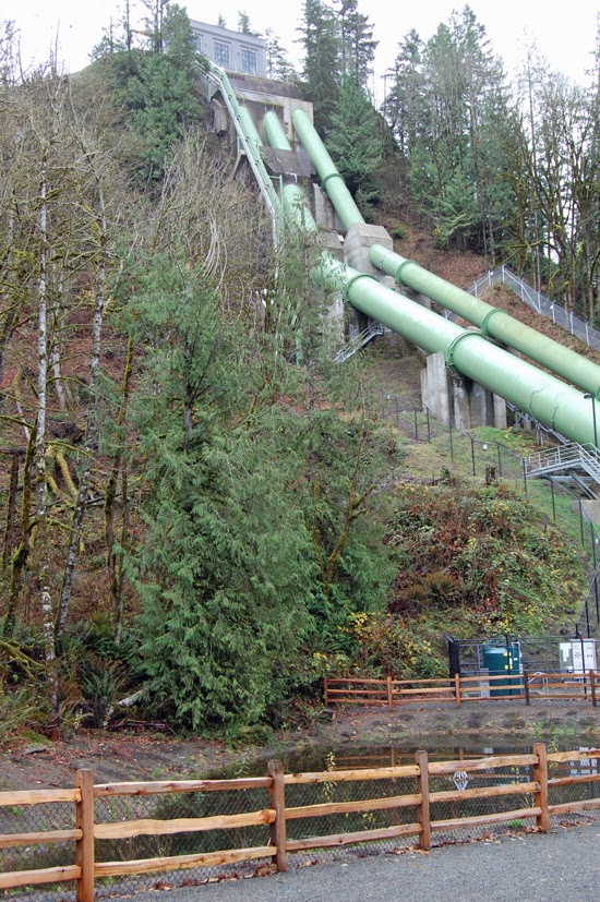
There's a path at the north end of the park that goes down to the bottom of the falls.  They've replaced the lower powerhouse and the pipes that go to it.  


The trail continues upstream to a small viewing area.  Too bad it doesn't go a little further.


We followed the trail back up the hill and across the pedestrian bridge.  At the south end of the parking lot we went through the brush and followed the narrow Tokul road a half-mile to where the Snoqualmie Valley Trail resumes.  It was nice to get back to the car - it was a cool, breezy, and a little rainy day.

Friday, November 15, 2013

Hike 7: North Bend Way to Reinig Bridge (North Bend to Snoqualmie)

Driving there:  From I-90 exit 32, turn north onto 436th Ave.  Turn right onto North Bend Way.  Go about 3/4 mile to where the Snoqualmie Valley Trail crosses the road at an angle.  Free parking on the side of the road.

We had a very flat hike today.  The weather wasn't bad for November, a little rain and a lot of clouds.  We had some closeup views of Mt Si and the surrounding mountains.  In a moment of creative genius, I deleted the photos.  So I went back later and took some pics of the Reinig Bridge:

 
If you walk down this trail you'll get smaller and smaller...


The trail goes through the backyards of North Bend, past Mt Si, a golf course, and through a couple of natural areas.  We saw a few walkers and cyclists.

 
Love locks
I've heard of love locks, but this is the first time I've seen them.  You can read all about them at:  http://abcnews.go.com/International/bridge-love-romance-padlocks-began/story?id=18488039  I'll have to come back some day and see if there are more...

Side trips:  Mount Si and Little Si


Tuesday, November 5, 2013

Hike 6: Cedar Falls trailhead to North Bend Way

Our next several hikes will be on the Snoqualmie Valley Regional Trail.  It's another abandoned railway that goes from Cedar Falls to Duvall.

Driving there:  From I-90 exit 32, turn south and follow the road a few miles to the Cedar Falls trailhead.  Discover pass required for parking.  I didn't see a machine in the lot.  The trail begins near the outhouses.

Up until today, we've had dry and often sunny weather for our walks.  But now it's November, and today started out cool and drizzly.  No snow yet!

The trail follows the road at first, but soon you're walking through the woods.  There are occasional houses, but it's mostly forest.  There are a few bridges and trestles, and lots of side trails.  We didn't see many walkers or cyclists today.

South fork of the Snoqualmie River

The trail passes through two nature reserves and crosses the south fork of the Snoqualmie.  We ran across some guys panning for gold.  They're probably about a hundred years too late, but you never know...   The trail passes under I-90 to North Bend way, where our getaway car was waiting.