Sunday, April 13, 2014

Hike 17: Bothell-Kenmore-Lake Forest Park

Driving there:  In downtown Bothell, park at the Bothell Landing Park.

Bothell Landing park.

After looking around the park, we crossed the bridge to the Sammamish river trail and turned right.   The trail merges into the Burke-Gilman trail, which is another old railroad grade.

There are several pedestrian/bike tunnels on this section of trail.

The trail is mostly along Bothell way, and some places are kind of noisy.  It's all paved, so wear comfortable shoes.  The trail users are mostly on bikes, with a few pedestrians.  And no horses! 

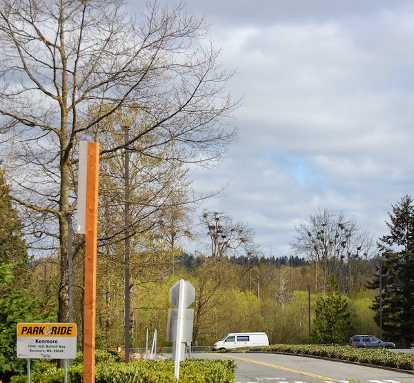
Heron nests in Kenmore.
 We followed the trail through Bothell and Kenmore, to Lake Forest Park (Ever since I learned to read I've been confused and amused by that name).  As we get closer to Seattle, the trail is alongside the lake and the views improved.  At 153rd we called it a day.  We're almost to Seattle!


Saturday, April 5, 2014

Hike 16: Redmond-Woodinville road to Bothell Landing

Driving there:  On the Redmond-Woodinville road, just south of NE 150th, there's a gravel parking lot on the west side of the road.

Looking west from Red-Wood road.
We continued west on the Tolt pipeline to the Sammamish river, then turned north onto the Sammamish river trail.  It's kind of nice to be on level ground again.

Sammamish river reflections


Today's walk was about 4 miles.  Lots of bicycles and walkers here.  The last half was a little rainy, but we survived.

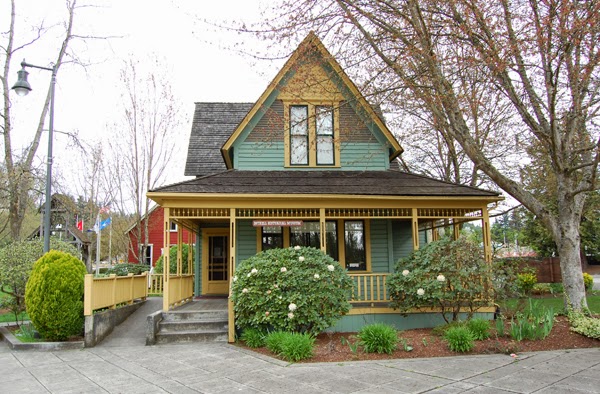
Old schoolhouse at Bothell Landing Park.

Cabin at Bothell Landing Park.
We crossed the river a couple of times, and ended up in Bothell Landing Park.  It's an interesting side trip, with a few old buildings to look at.

Friday, April 4, 2014

Hike 15, Tolt pipeline 168th to Redmond-Woodinville road

Driving there:  From the Redmond-Woodinville road, at the Hollywood Schoolhouse, go east on NE 146th Pl.  The road changes from 146th to 156th to 160th to 143rd and then 168th Ave NE.  Park where the pipeline crosses the road.

Today's hike was short, about a mile. There's not much to say about the Tolt pipeline, it goes up and down and you're always looking into the backyard of somebody's McMansion.
155th Ave NE


Looking east across 155th
  

Looking west across the Sammamish valley.
 
The weather was good, but changing rapidly.  There were a few small ups and downs, and then a long steep downhill roll into the Sammamish valley. 

Hike 14: Tolt pipeline, 216th to 168th

Driving there:  From Redmond, take the Novelty hill road east.  Turn left on Trilogy parkway.  Trilogy Pkwy becomes NE 133rd.
Turn right onto 218th Ave NE.
Turn left onto NE 140th Pl.
NE 140th Pl becomes 216th Way NE.
Turn right onto 216th Ave NE (not a typo, check your map:-)
Look for parking where the Tolt pipeline crosses the road.

Tolt pipeline looking west from 216th.


In a couple of places you can actually see the pipeline.  It's pretty exciting...


Looking east across Avondale road to the Cascades.
Lots of ups and downs and suburban backyards along this trail.

Saturday, March 15, 2014

Hike 13: Tolt pipeline, West Snoqualmie Valley road to 216th

Driving there:  This is a tricky one.  There are two pipelines, and the wrong one is the easiest to find.  Near Duvall WA, at the intersection of Novelty Hill Rd and West Snoqualmie Valley Rd, head north.  At 0.5 miles, there's a wide spot on the left side of the road with a wide cleared area going up the hill.  I don't know what it is, but it's not the Tolt pipeline.  Continue north another 0.4 miles.  Look for the Tolt pipeline on the left side.  There's not much to see, just a cleared area going up the hill.  If you pass a collapsed barn you've gone too far.  There's no parking at all.  Go back to the first pipeline to park.

We parked at the only place we could on this godforsaken road, and walked north on the narrow West Valley road to the Tolt pipeline.
Skunk Cabbage

I wonder if it tastes as good as it smells?


It's a kind of a scramble through the bushes up the hill - no trail at all, just mud and blackberries.  It's steep, too, but about halfway up the hill we hit the end of the maintained trail and the going improved considerably.

Looking east across the West Valley road.

The Tolt pipeline is a 100 foot wide right-of-way for a pipe that carries water from the Tolt river to Seattle and the suburbs.  It's pretty popular with walkers, joggers, bicyclists, and horses.  It tends to be pretty straight, but there are a lot of ups and downs. 

Are you looking at me?


We haven't hiked in 6 weeks, and the hill was steep, so we only made 3 miles today.
 

Tuesday, February 4, 2014

Hike 12: Fay road to Tolt Pipeline (Stillwater to Duvall)

Driving there:  Take highway 203 north from Carnation for 3 or more miles.  When you see Fay Road on the right, slam on the brakes and turn left into a parking area.  Discover pass required, no machine here.

We had a cool and foggy morning for our last hike in the Snoqualmie Valley.  We continued along the railroad grade, past beaver ponds and farms.

Beaver pond in the fog

This part of the trail is pretty close to the highway.  We stopped for lunch and watched some flocks of noisy birds fly over.

Heading south.
Groundhog Day
At 124th we said farewell to the Snoqualmie Valley trail and headed west to find the Tolt pipeline.  The Tolt pipeline trail is missing a section, so we crossed the valley on 124th and turned north on the West Snoqualmie Valley road.  Neither road has adequate shoulders for walking.  North of 124th the Tolt pipeline goes up the hill on the west side of the road.  There's no trail going up the hill, but we'll worry about that next week.


Tuesday, January 21, 2014

Hike 11: NE 11th St to Fay Road (Carnation to Stillwater)

Driving there:  From Highway 203 south of Carnation, turn East onto NE 11th Street.  In about a block the paved road curves left, but you continue straight East on the gravel road.  Just before the sign "Griffin Creek Natural Area", turn left into a free parking area.

I figure we're about halfway on our trip to Puget Sound.  Today may also be the flattest section of the trip.  It's been a pretty dry winter so far, and we had another sunny day.  The trail crosses the Tolt river and goes through the back of Carnation, and past a "disc golf" park.  Ya learn somethin' new every day!


Tolt river


Most of King county is wooded and hilly, so I really enjoy the long views and straight lines around here.

Huh?
We went through the fields, across the highway, and past the beaver ponds at Stillwater, ending up in a hunting reserve on a beautiful January afternoon.